IO Monitor 3m Land Cover
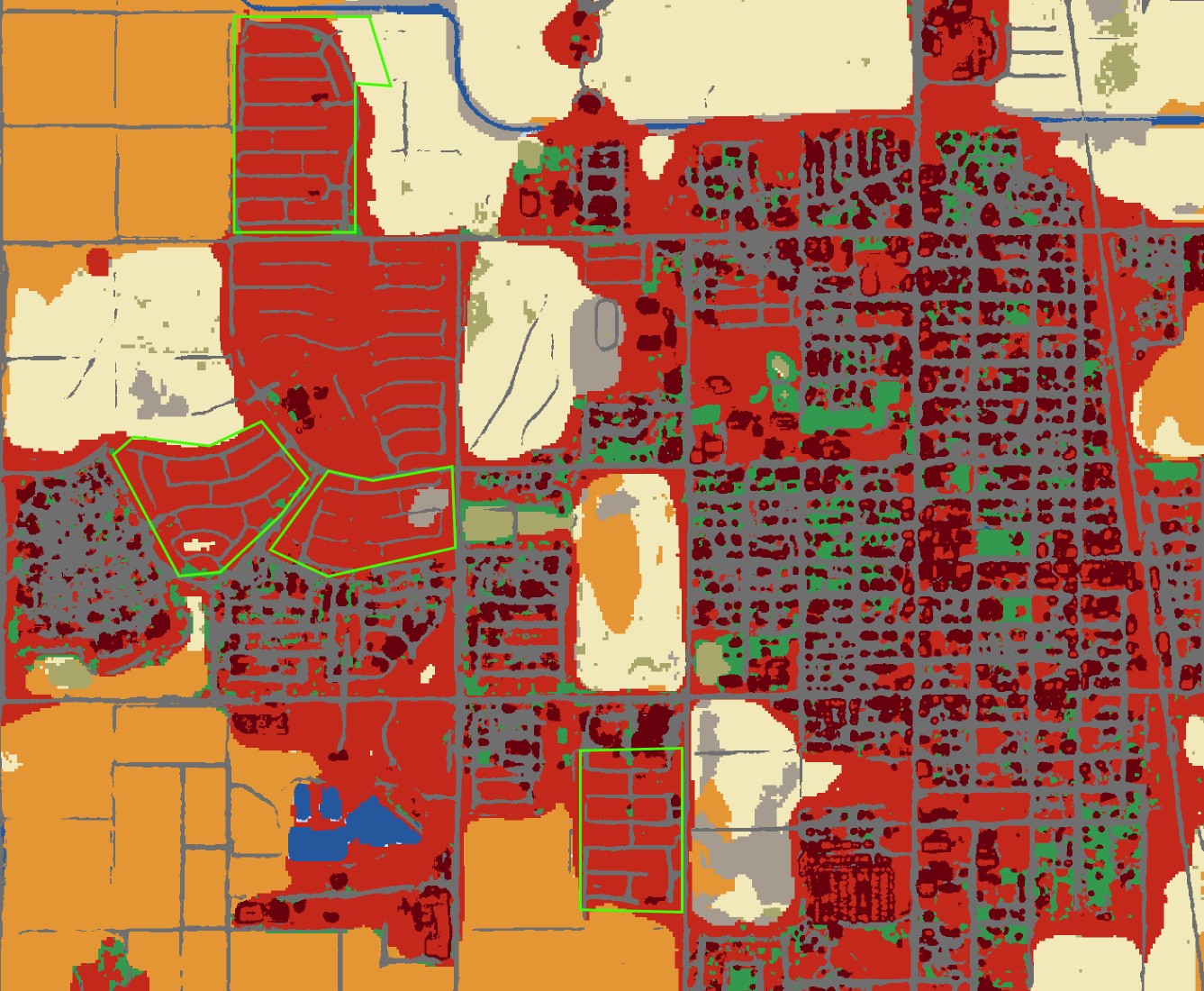
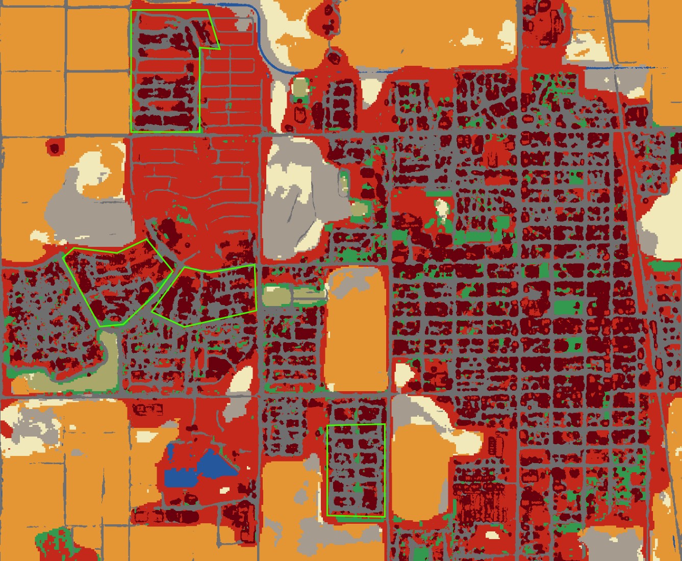
 3m Land Cover map over Berlin, Germany, 2023
What is 3m Land Cover?#
Impact Observatory's 3m Land Cover is created in partnership with Planet for our highest resolution land cover data yet. Daily PlanetScope satellite imagery at 3-meter resolution combined with Sentinel 2 satellite imagery enables the most up-to-date maps and insights over any custom area of interest.
3m Land Cover fills critical information gaps with more frequent updates, higher resolution detail, and new classes in urban areas, including Buildings, Roads, Other Built Areas, and Mixed Vegetation. These new land cover classes accompany our 10m Land Cover classes, enabling a wide range of land monitoring applications for decision-makers in NGOs, government, and industry.
3m Land Cover is available for purchase by contacting hello@impactobservatory.com. Every order includes a Cloud Optimized GeoTIFF (COG), PNG and CSV of pre-calculated metrics.
Land Cover Classes#

Example Use Case: Construction and Agriculture Monitoring in Coolidge, Arizona, USA#

3m Land Cover data from 2020 and 2023 reveals new cropland growth and building construction in Coolidge, Arizona, USA.
3m Land Cover Class Definitions#
| Class Name | Description |
|---|---|
| Water Channel Extent | Full extent of water under normal circumstances (maximum long-term footprint outside of flooding or other exceptional events). Covers areas like lake beds and arroyos where water might be present regularly, but only seasonally. |
| Variable Water | Intermittent water flow or standing water, representing seasonal fluctuation in cover, weather events, or human activities. At times this class may occur due to frequent turbidity, algal blooms, ice cover, pollution, or glare. |
| Persistent Water | Sustained water flow or standing water, representing permanent or sustained seasonal cover. |
| Snow/Ice | Large, homogenous areas of persistent snow or ice, typically only in mountain areas or high latitudes. |
| Bare Ground | Areas of rock or soil with very sparse to no vegetation for the entire year; large areas of sand with little to no vegetation; examples: exposed rock or soil, desert, dry salt flats, dry lake beds. |
| Sparse Rangeland | Vegetation that is some mix of grasses and/or dispersed, short, woody scrub, with or without some bare ground cover. May contain small isolated trees. Defined as a rangeland prediction with a maximum NDVI value less than a biome-specific threshold during the given time period. |
| Dense Rangeland | Healthy, closely packed vegetation that is predominantly dense, short (under 5m) woody shrubs with very little to no mixed grass or bare ground cover. May contain small isolated trees. Within and around areas classified as built, this class can also include highly manicured lawns or fields. Defined as a rangeland prediction with a maximum NDVI value greater than or equal to a biome-specific threshold during the given time period. |
| Flooded Vegetation | Areas of vegetation with obvious intermixing of water throughout the majority of the given time period; mostly herbaceous (non-woody) vegetation and/or scattered tree (mangrove)/scrub/shrub cover. Thick mangrove, swamp, or seasonal wetland may fall under their next-best-fit vegetation classes if water is not observed during the given time period. |
| Sparse Tree | Vegetation that is predominantly tree canopy cover (vegetation over 5m high) with some mixing of other vegetation or bare ground due to relatively thin leaf cover and/or dispersed distribution of trees. In some circumstances this class can also indicate trees gaining/losing leaves or dying/growing during the given time period. Defined as a tree prediction with a maximum NDVI value lower than a biome-specific threshold during the given time period. |
| Dense Tree | Healthy, closely packed tree canopy cover (vegetation over 5m high) with very little to no vegetation or bare ground cover. Defined as a tree prediction with a maximum Normalized Difference Vegetation (NDVI) value greater than or equal to a biome-specific threshold during the given time period. |
| Mixed Vegetation | Mixed types of vegetation, primarily in the vicinity of human structures and settlement. |
| Inactive Cropland | Fallow or otherwise inactive fields, sometimes mixed with small infrastructure in close proximity of active crops. |
| Active Cropland | Actively growing crops, irrigated pastures, and other vegetation actively managed by humans. |
| Building | Built up artificial construction with no vegetation. |
| Road | Paved surfaces created by humans for transportation, does not include dirt roads. |
| Other Built | Unidentified impervious surface in relation to buildings/roads. |
| Clouds | No land cover information due to continual cloud cover. |
3m Land Cover Class Colors#
| Raster Value | Class Label | Hex Color Value |
|---|---|---|
| 0 | No Data | #000000 |
| 11 | Water Channel Extent | #ffffff |
| 12 | Variable Water | #bfdaf5 |
| 13 | Persistent Water | #25579d |
| 30 | Snow/Ice | #a8ebff |
| 40 | Bare Ground | #a59b8f |
| 61 | Sparse Rangeland | #aecca1 |
| 62 | Dense Rangeland | #a9a76a |
| 80 | Flooded Vegetation | #7a87c6 |
| 101 | Sparse Trees | #f1e9b9 |
| 102 | Dense Trees | #005e24 |
| 130 | Mixed Vegetation | #32994E |
| 141 | Inactive Cropland | #E4B479 |
| 142 | Active Cropland | #CB852F |
| 175 | Building | #67000D |
| 185 | Road | #6F6F6F |
| 199 | Other Built | #C4281B |
| 240 | Clouds | #616161 |
3m Land Cover GeoTIFF Technical Specifications#
| Name | Specification |
|---|---|
| File Types | Cloud Optimized GeoTIFF (COG), PNG, CSV of metrics |
| Compression | LZW |
| Projection | EPSG:3857 - WGS 84 / Pseudo-Mercator – Spherical Mercator |
| Extent | Custom to user-selected area of interest |
| Resolution | 3 meters |
| No data value | 0 |
Legal#
All IO Monitor maps are governed by our End User License Agreement.